Wānanga on 23 May 2026 was a big success!

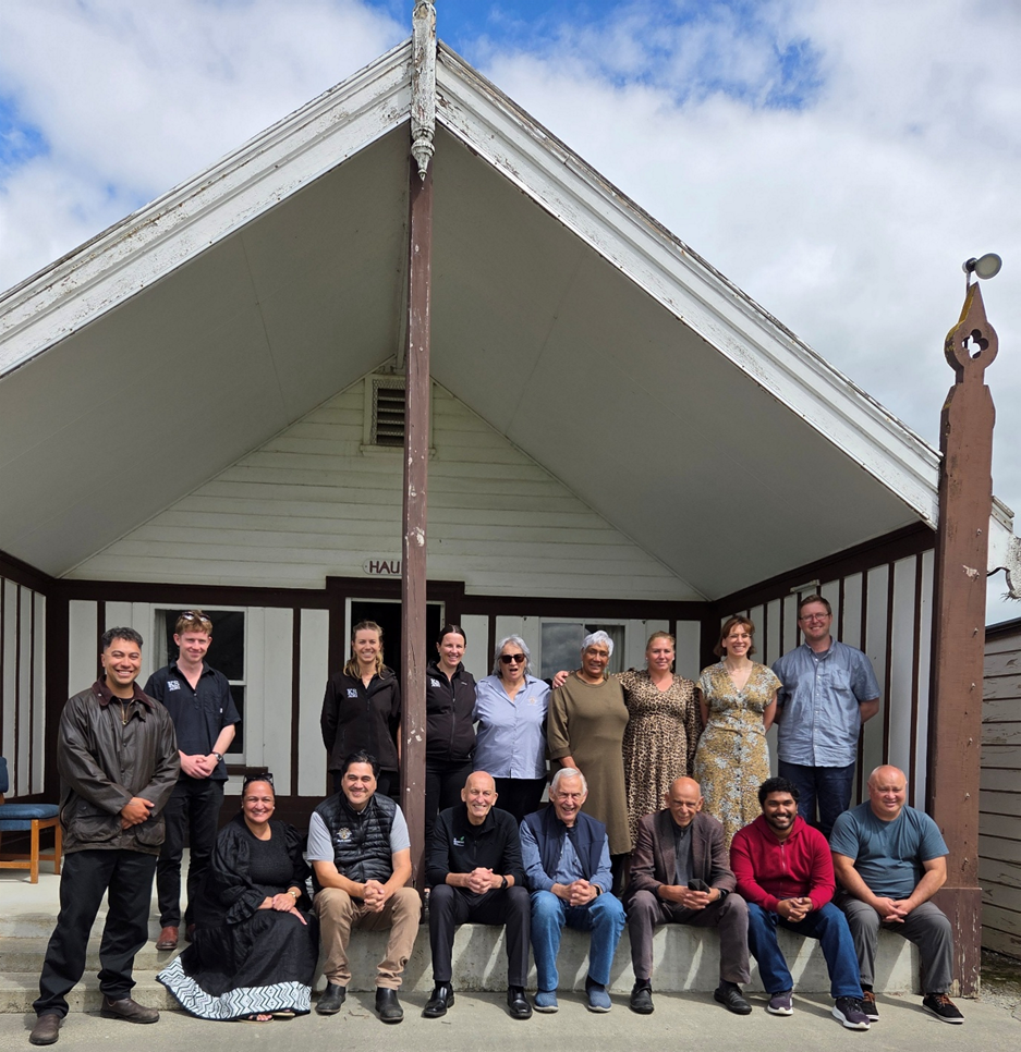
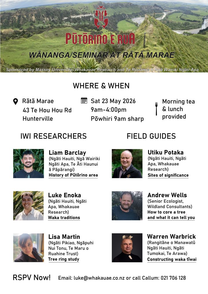
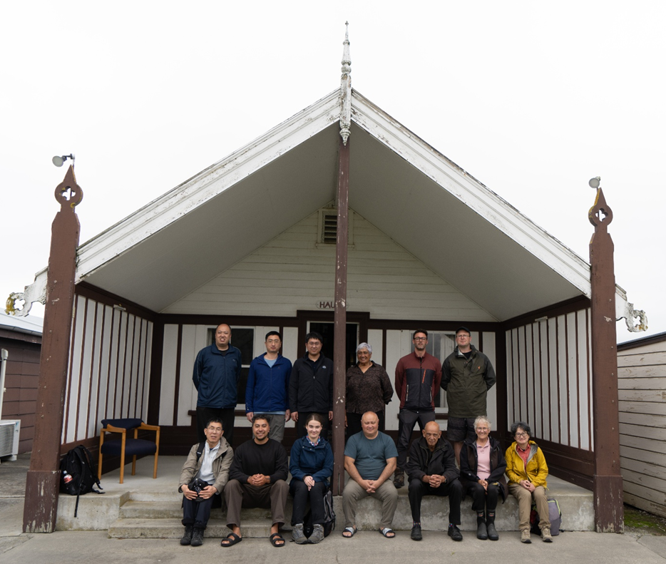
On 23 May 2026, around 40 participants gathered at Rātā Marae for a highly successful Pūtōrino e Rua wānanga. Blessed with fine weather and clear skies, the day began at 9:00 am with a pōwhiri, followed by morning tea.

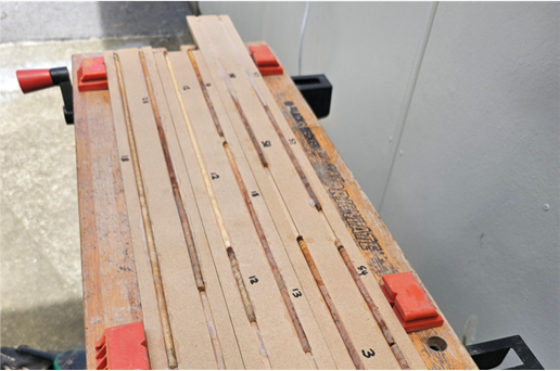
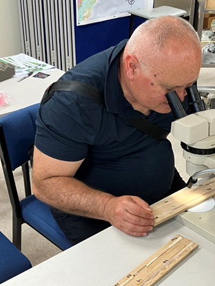
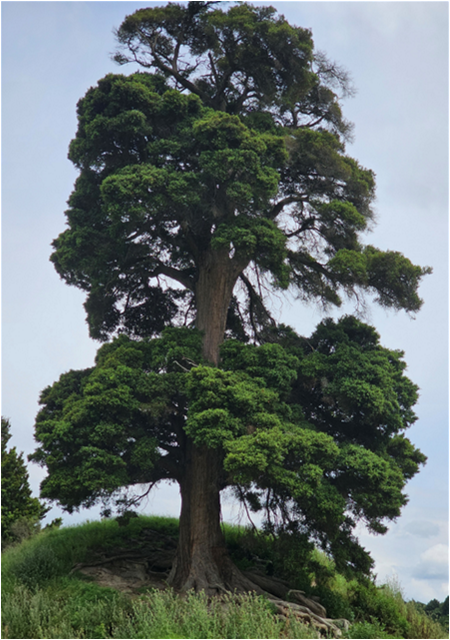
The morning session featured presentations from iwi researchers Lisa Martin, Liam Barclay, and Luke Enoka, who shared insights into tree-ring research, the history of the Pūtōrino area, and waka traditions. A particular highlight was viewing a selection of stumps and logs sampled by the research team from Merchiston Estate for tree-ring dating. Some of these samples are approximately 300 years old. Given that the trees were felled during land clearance more than a century ago, the findings indicate that the landslide deposits at Merchiston Estate are likely more than 400 years old—significantly predating both the 1855 Wairarapa Earthquake and European settlement in this part of the Rangitīkei Valley.

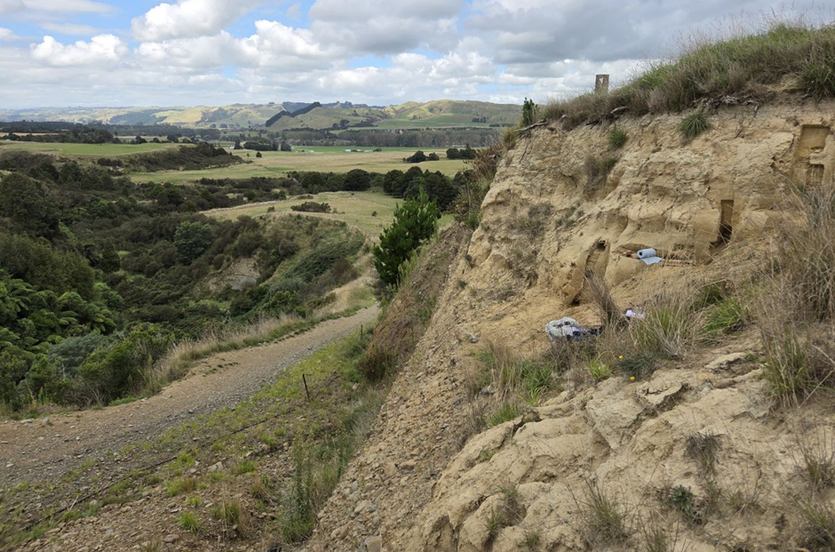
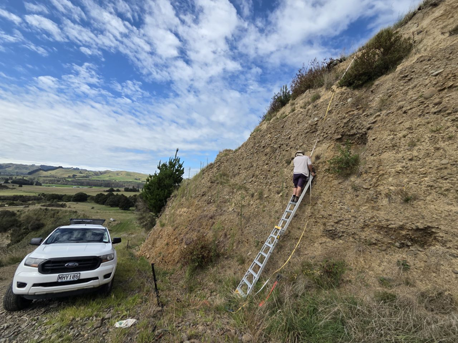
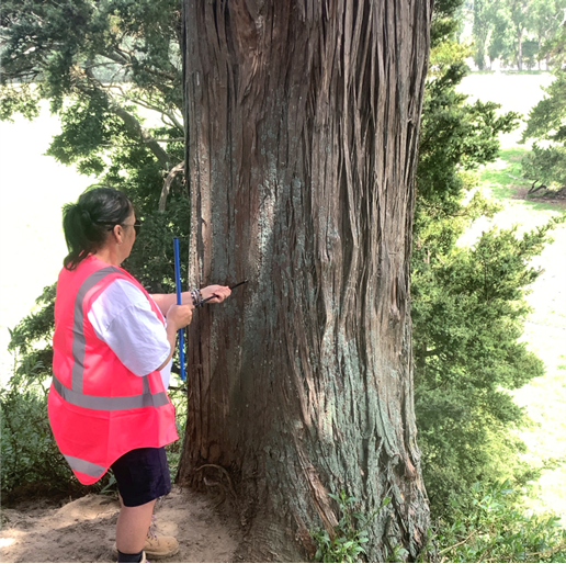
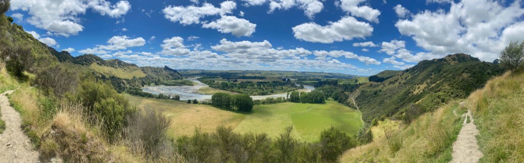
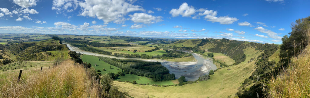
Following a magnificent lunch prepared by the marae, including brandy snaps with fresh cream, participants headed into the field. Dr Andrew Wells of Wildlands Consulting demonstrated how to extract tree cores from tōtara trees, providing a hands-on introduction to dendrochronology techniques. The group then visited Te Hou Hou, where Utiku Potaka shared the rich history of the area and guided participants to a stunning vantage point overlooking the surrounding landscape.

The day concluded with a visit to a waka and pātaka located on John McManaway’s dairy farm. Here, Warren Warbrick spoke about traditional waka construction methods and demonstrated how large waka were crafted using stone tools.

The wānanga provided a valuable opportunity to share research progress, connect science with mātauranga Māori, and strengthen relationships between researchers, mana whenua, landowners, and the wider community. The enthusiasm and engagement shown throughout the day highlight the growing momentum behind the Pūtōrino e Rua project and its efforts to better understand the history of this remarkable landscape.

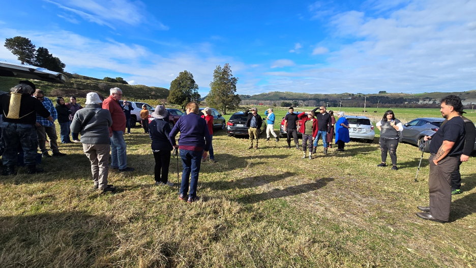
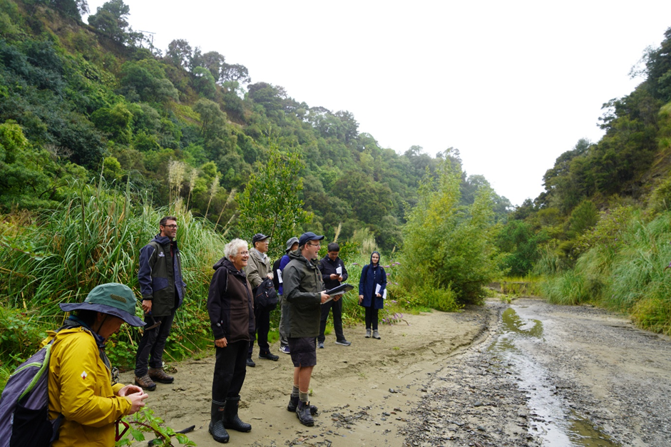
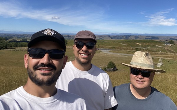
Attendees are getting split into two groups down Te Hou Hou Road for a field trip

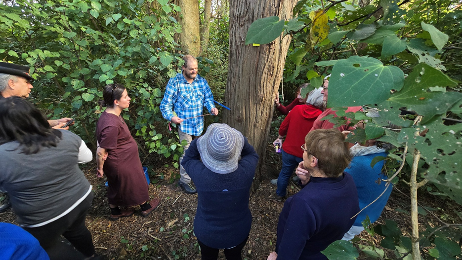
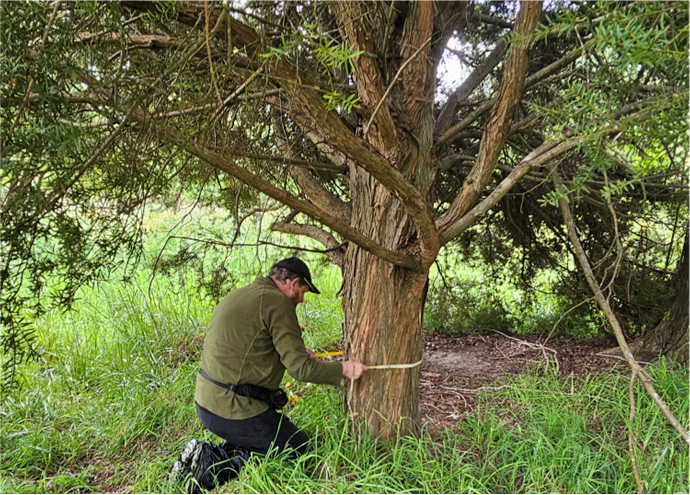
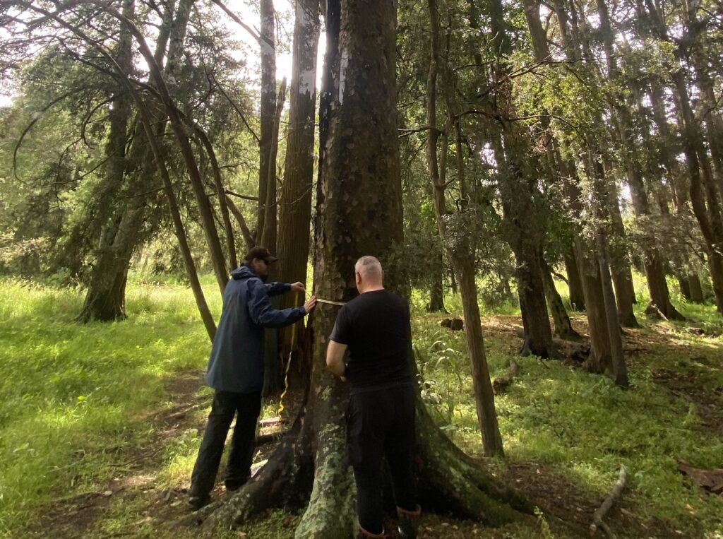
Dr Andrew Wells coring a Podocarpus totara at Pātōtara and explaining what information you can learn from dendroecology

Whakamarama i te Onamata: Illuminating past dust flux dynamics in the lower North Island of Aotearoa New Zealand

Kaja Fenn (University of Liverpool) has been working with Utiku Potaka (Ngāti Hauiti), Alan Palmer and Callum Rees (Massey University) on research exploring dust deposits and landscape evolution in the lower North Island of New Zealand. This work forms part of a collaborative initiative involving Massey University, University of Liverpool, iwi partners, and local landowners.

Recent fieldwork across the Rangitīkei and Oroua valleys has focused on mapping and sampling loess, river terraces, and associated deposits to better understand how these dynamic landscapes formed over time. Sites on the Rata (Rātā) and Porewa (Pourewa) terraces, including well-preserved tephra layers, are providing important reference points for reconstructing past environmental conditions. This work complements newly published research, which presents new type sections for the last glacial river terraces in the Rangitīkei River Valley.

Together, these efforts aim to improve our understanding of Southern Hemisphere dust records by developing new chronologies and environmental reconstructions. The collaboration combines field expertise in Aotearoa New Zealand with luminescence dating capabilities at the University of Liverpool, contributing to a growing international research network and laying the groundwork for future research outputs and funding opportunities.

View east over the Rangitīkei Valley at the Rata (Rātā) Terrace type section (photo by Kaja Fenn).

Alan Palmer measures and samples a sand lens within the Rata (Rātā) terrace gravel alluvium for luminescence dating (photo by Kaja Fenn).

Kaja Fenn participating in a hui on 6 March 2026 and taking the opportunity to share her research expertise with Ngāti Hauiti and build connections.

Dendroecology (tree ring) study

Over the 2025-2026 summer period, Lisa Martin (Ngāti Pikiao, Ngāpuhi
Nui Tonu, Te Maru o Ruahine Trust) undertook a dendroecology or tree-ring study together with Andrew Wells (Wildlands Consultants), Utiku Potaka (Ngāti Hauiti, Ngāti
Apa, Whakauae Research) and Callum Rees (Massey University).

The aim of the study was to build a record of environmental change over time from native trees to better understand how the landscape has formed over time and what impact landslides have had around Pūtōrino.

The first step was to map remnant native vegetation across the study area using historic aerial imagery and ground truthing. This mapping was then used to target field work carried out between the 23rd and 27th of Nov 2025. A total of 59 cores were taken from a range of native trees, including Totara, Matai, Kahikatea, Rimu, Kanuka, Ngaio and Rewarewa. Six slabs were taken from stumps and logs that date back to when the area was first cleared.

The cores were taken using a range of Swedish-made Haglof Increment Borers that take a pencil-sized core from the trunk of a living tree. Extracting a core wounds the tree. However, trees respond to the borer hole as they would any other wound, isolating the injured tissue through compartmentalisation to resist the spread of pathogens. This means risk to tree health is low and can be minimised by using a clean, sharp increment borer and angling the borer slightly upwards to prevent water and dirt from running into the hole. Our native trees can be hundreds and, in some cases, thousands of years old, providing an important window into the past.

Lisa Martin starting a core on a Totara tree using a 500 mm long Haglof Increment Borer

Andrew Wells measuring the diameter of a 70-year-old totara tree that had become partly buried in flood sediment adjacent to the Rangitīkei River.

Once the cores were taken, they were glued into pre-made MDF boards with 5 mm grooves cut into them. Careful attention was paid to mark the bark and centre of each core together with the sample number. Tape was applied to ensure a tight fit while the PVA glue set. Once the cores had dried they were brought to Massey University for sample prepartion. The MDF board provides a level surface from which to start sanding into the core, beginning at coarse grit (60) and incrementally going finer up to 200 grit. Once sanding was complete, a binocular microscope was used to start counting the rings and filling the data out in a spreadsheet.

Dry cores mounted onto MDF board ready for sanding.

Utiku Potaka counting tree rings on finished cores

A large totara tree in the study area was found to be close to 300 years old.

To learn more about the key findings from this report, come along to the next wānanga being held at Rātā Marae on the 23rd May 2026.

International Sedimentological Congress Field Trip Showcases Geology and Cultural Connections in Ngāti Hauiti Rohe

International Sedimentological Congress Field Trip Showcases Geology and Cultural Connections in Ngāti Hauiti Rohe

On 22–23 January 2026, researchers and industry professionals from around the world participated in a pre-conference field trip associated with the International Sedimentological Congress entitled Distal Sedimentation from Large-Volume Silicic Eruptions in a Regression-Dominated Marine Environment. The field trip showcased the internationally significant geology of the Pūtōrino e Rua study area and the wider Ngāti Hauiti rohe, while also highlighting the deep cultural connections that exist between people and place.

The first day began at Waitapu Stream, where participants explored an exceptional exposure of a ~100 m thick cyclothem representing shallow marine deposition approximately 900,000 years ago. The section contains the first occurrence of the Kaukatea Pumice in the Whanganui Basin stratigraphy, providing important insights into the timing and impacts of large silicic volcanic eruptions on marine sedimentation.

A major highlight of the trip was the visit to Rātā Marae, where participants were welcomed with a pōwhiri and hosted for lunch. Utiku Potaka shared the history of the area and explained the special relationships Ngāti Hauiti have with the landscapes and sites visited during the field trip. For many international visitors, this was a unique opportunity to gain an understanding of Māori culture and its interconnections with the environment and geology.

Following the marae visit, the group travelled to Otara Bridge to examine the Tuhua Shell Bed. Thanks to the efforts of Jack Baker, who had cut a path and constructed a stile to allow safe access across a seven-wire fence, participants were able to visit this important site. Here, they observed evidence of Zygochlamys delicatula, a cool water scallop species that migrated into the Whanganui Basin around 2.4 million years ago. Its arrival provides some of the earliest evidence in New Zealand for the onset of major Northern Hemisphere glaciations and the expansion of large continental ice sheets.

After an evening at Makoura Lodge, the field trip continued with visits to Table Flat, the Oroua Valley Lookout, and the Manawatū Saddle. These sites provided spectacular views of the basin sedimentary record, including evidence of a large fan delta. Together, the field localities illustrated how tectonics, sea-level change, climate, and volcanism have interacted to shape the evolution of the Whanganui Basin through time.

The field trip brought together participants from New Zealand, China, Japan, Poland, South Korea, Saudi Arabia, and elsewhere, fostering international collaboration and knowledge exchange. By combining world-class geological exposures with the stories and perspectives of mana whenua, the excursion provided a memorable and uniquely Aotearoa experience for all involved.

The success of the trip demonstrates the international significance of the Pūtōrino e Rua study area, not only as a natural laboratory for understanding Earth’s history, but also as a place where geological and cultural narratives can be shared together to enrich scientific understanding.

Field trip participants visiting Rātā Marae on 22 Jan 2026

Callum Rees showcases the special geology at Waitapu Stream, where you can see the unconsolidated sandy deposits of the Kaimatira Pumice Sand Formation, which has failed at Pūtōrino to create the Pūtōrino Landslide.

Presentations from wānanga at Rātā Marae – 22 Nov 2025

Here are the video recordings of six presentations from a wānanga held at Rātā Marae on 22nd of Nov 2025 for the Pūtōrino e Rua project, including:

  1. Callum Rees (Massey University) – brief introduction to the Pūtōrino e Rua project
  2. Utiku Potaka ((Ngāti Hauiti, Ngāti Apa, Whakauae Research) – Early iwi occupation in the central Rangitīkei
  3. Warren Warbrick (Rangitāne o Manawatū, Ngāti Hauiti, Ngāti, Tumokai, Te Arawa) – Revival of waka tīwai
  4. Dilys Johns (Auckland University) – Conservation of wet organic taonga in Aotearoa
  5. Andrew Wells (Ecologist at Wildlands) – How to read tree rings and what they tell us about the land
  6. Jeff Watson (Horizons) Historic flood events in the Rangitīkei Valley

Whakauae Research Update

The Whakauae Research team includes Utiku Potaka (Project Lead), Ben Barton, Luke Enoka and Liam Barclay (Ngāti Hauiti, Ngā Wairiki Ngāti Apa, Te Āti Haunui ā Pāpārangi).  The team are tasked with collecting Ngāti Hauiti kōrero tuku iho (traditional tribal narratives) and historical whakaahua (images) of the central Rangitīkei River valley to describe the tribal mātauranga (knowledge) surrounding the event, people and place.

In October 2024, Ben created a comprehensive index of historical material and information required for the project.  This also served as the framework for the digital document bank of primary source material, including Māori Land Court Minute books, manuscripts, images and maps.

In November 2024, Liam began transcribing handwritten Māori Land Court minute books, which contain material evidence related to the project.  This was a challenging process that required patience, skill, and overall, a keen interest in the evidence.  The first part of the transcribing is complete, which focused on ‘evidence in chief’ of witnesses.  During his time, he has been able to find records of burials for two of Hauiti’s children, an unexpected treasure found among the minute books he spent reading over the summer.  Liam said “the exciting thing about these kinds of discoveries, and where this may link to the broader aspirations of Whakauae, is that these findings might be found in the tari but eventually shared in the wharepuni”.

The Whakauae team also went on a hīkoi (field trip) into the Rangitīkei River valley to connect sites recorded in the minute books with the actual places.  This process of ‘takahia te whenua’ or tramping the land helped give context to the material being transcribed and will eventually add to the mātauranga being compiled.  This hīkoi was an opportunity to wānanga about Ngāti Hauiti mātauranga and sites of significance in the Pūtōrino vicinity.

Whakauae Research Team: Liam Barclay, Luke Enoka, Utiku Potaka on a site visit in the Rangitīkei
River valley.

Pūtōrino e Rua reaches Year 1 Milestone

The Pūtōrino e Rua project officially began in June 2024 and is just crossing over into its second year. As part of this milestone, we have submitted a report to the Ministry of Business, Innovation & Employment (MBIE) outlining work completed to date and our plans moving forward.

As we move into year two, the project team are collaborating with Dilys Johns from the University of Auckland and Daniel Parker from InSite Archaeology to document two waka tīwai found within the study area. Andrew Wells, a senior ecologist at Wildlands Consultants is also teaming up with an intern from Whakauae Research to undertake dendrochronology (tree ring analysis), using a range of podocarp trees preserved within the study area. This will help constrain the age of the landslide surfaces and provide information on the environment over time. The team are also working closely with iwi artists to bring the project story to life, providing visualisations for the public that convey mātauranga and western science.

Keep an eye out for more photos and videos as the project progresses!

Utiku Potaka (Ngāti Hauiti) and Andrew Wells (Senior ecologist at Wildlands Consultants) measuring diameter at breast height (DBH) using a tape on an 83 DBH Matai tree at Te Mahoe/Merchiston Estate Flats.
View west across the Rangitīkei Valley from Potaka Station

Pūtōrino e Rua Project Video

The Pūtōrino e Rua team have released a video to let people know what this project is all about.

You can find the video here

Huge thanks go to Sacha Keating (Te Āio Productions) and Abby Kingi (Lamp Studios) for putting this fantastic video together for us.

View from Parororangi on a fine day looking west across the Rangitīkei Valley